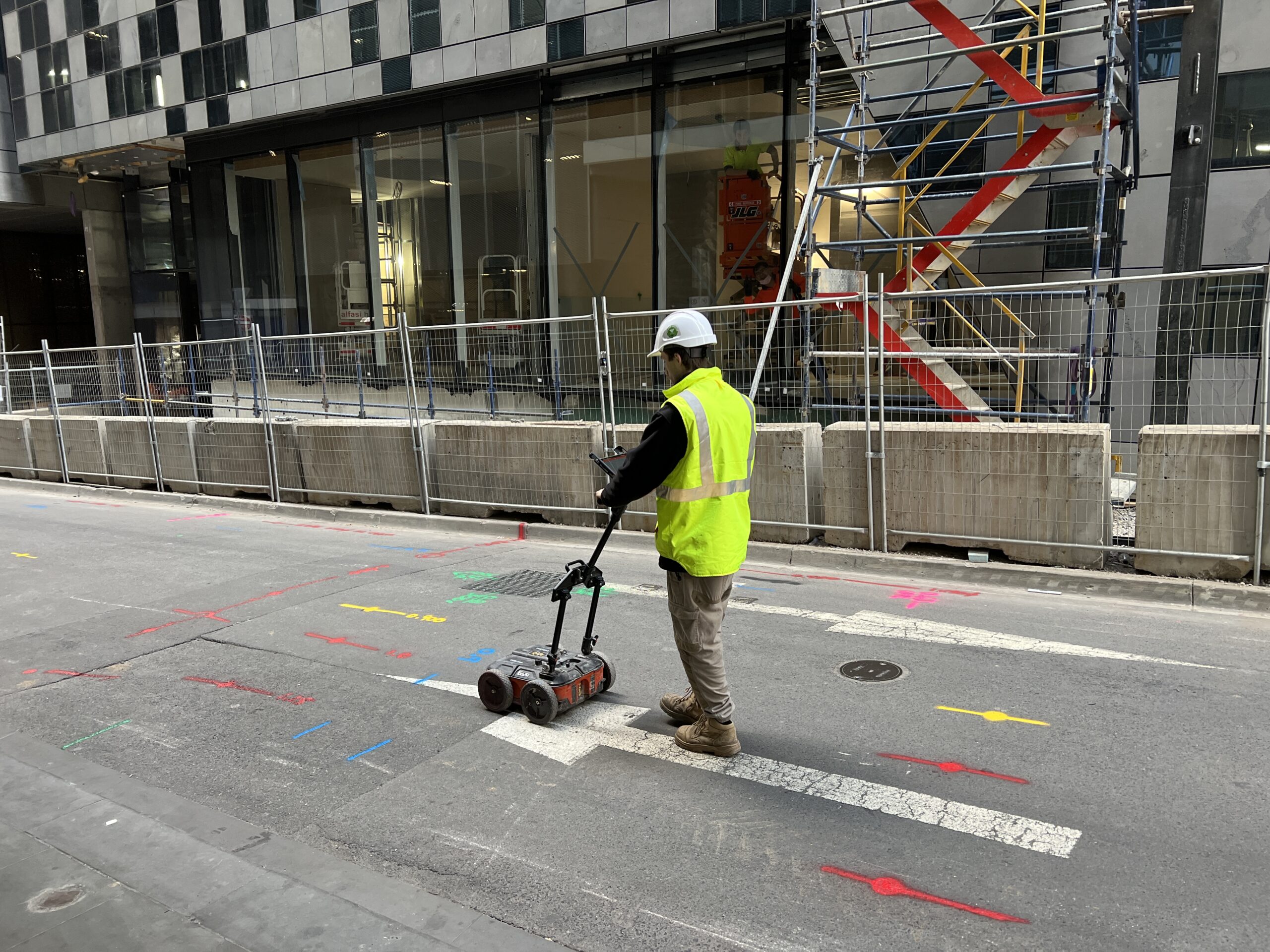
Underground Service Locating: Protecting Your Project and Infrastructure
Before breaking ground on any construction, excavation, or drilling project, there’s one critical step that can mean the difference between success and catastrophe: underground service locating. This essential process identifies and maps the hidden network of utilities beneath our feet, preventing costly damage, project delays, and potentially life-threatening accidents.
What is Underground Service Locating?
Underground service locating, also known as utility detection or subsurface utility engineering, is the process of identifying and mapping buried infrastructure before excavation or construction begins. This includes electrical cables, gas lines, water mains, sewer pipes, telecommunications cables, stormwater drains, and other essential services that run beneath roads, footpaths, and properties across Australia.
With millions of kilometres of underground utilities crisscrossing beneath Australian cities and suburbs, accurate service location has become an indispensable component of safe construction practices.
Why Underground Service Locating is Critical
The consequences of striking an underground utility can be severe, ranging from minor inconveniences to major disasters. Understanding these risks highlights why professional service locating is not optional—it’s essential.
Preventing Catastrophic Damage
Striking a high-voltage electrical cable can cause electrocution, fires, and widespread power outages affecting thousands of residents and businesses. Puncturing a gas main creates immediate explosion risks and requires emergency evacuations. Damaging water mains floods construction sites and disrupts water supply to entire neighbourhoods.
Avoiding Financial Losses
The cost of repairing damaged utilities often runs into tens or hundreds of thousands of dollars. Beyond direct repair costs, contractors face liability claims, regulatory fines, and extended project delays. Insurance premiums increase, and repeat incidents can result in loss of licences and certifications.
Protecting Workers and the Public
Worker safety remains the paramount concern. Underground electrical cables pose electrocution hazards, while gas leaks create explosion risks. Even seemingly minor utility strikes can create dangerous working conditions that put construction crews and nearby residents at risk.
Maintaining Project Schedules
Unexpected utility strikes bring projects to an immediate halt. Emergency repairs, investigation procedures, and regulatory compliance requirements can delay projects for days or weeks, cascading into missed deadlines and contractual penalties.
Common Underground Services in Sydney and NSW
Understanding what lies beneath Australian construction sites requires knowledge of the diverse utility infrastructure installed over decades of development.
Electrical Services
Power distribution networks include high-voltage transmission lines, medium-voltage distribution cables, and low-voltage service connections. Many older suburbs feature overhead power lines, but modern developments and urban areas increasingly rely on underground cabling ranging from low-voltage residential services to high-voltage feeders carrying thousands of volts.
Gas Infrastructure
Natural gas distribution systems serve homes and businesses across Sydney and NSW. These pressurised pipelines require special care during excavation, as damage can result in immediate danger to workers and surrounding properties.
Water and Sewer Systems
Water supply systems include large trunk mains, distribution pipes, and individual service connections. Sewer systems comprise gravity-fed collection pipes, pressure sewer systems, and pumping stations. Understanding pipe materials—from modern PVC to heritage ceramic and cast iron—affects detection methods.
Telecommunications Networks
The telecommunications revolution has created dense networks of copper cables, fibre optic lines, and conduits beneath Australian cities. NBN infrastructure, mobile network cables, and legacy Telstra networks all require identification before excavation.
Stormwater Drainage
Urban stormwater systems include council drains, private drainage, detention basins, and complex pit and pipe networks designed to manage Sydney’s intense rainfall events.
Professional Service Locating Methods
Modern underground service locating combines multiple technologies and techniques to create comprehensive utility maps.
Electromagnetic Location (EML)
Electromagnetic locators detect the electromagnetic fields generated by conductive utilities. Operators use specialised equipment to transmit signals into underground cables or pipes, then trace these signals to map utility locations. This method works effectively for metallic services including electrical cables, gas pipes, and water mains.
Ground Penetrating Radar (GPR)
Ground penetrating radar uses high-frequency radio waves to image subsurface structures. GPR excels at detecting non-metallic utilities like PVC pipes, concrete structures, and underground voids. The technology provides detailed depth information and can identify multiple utilities in congested areas.
Radio Frequency Location
Radio frequency (RF) locators detect signals emitted by telecommunications and power cables. This passive detection method identifies active services without requiring direct connection or signal injection.
Physical Potholing
When electronic methods require verification or congested areas make interpretation difficult, physical potholing provides definitive confirmation. Non-destructive excavation techniques, including hydro-excavation and vacuum excavation, expose utilities for visual inspection without causing damage.
Utility Records Research
Professional service locating begins with comprehensive records research. Dial Before You Dig (DBYD) provides access to utility owner plans, but these records often lack precision. Experienced locators supplement DBYD information with council records, historical plans, and as-built drawings to build a complete picture.
The Service Locating Process
Effective underground service locating follows a systematic approach that ensures comprehensive coverage and accurate results.
Stage 1: Desktop Assessment
The process begins with thorough research. Locators submit Dial Before You Dig requests, review council records, examine previous site investigations, and analyse aerial imagery. This desktop assessment identifies known utilities and potential challenges before field work commences.
Stage 2: Site Survey
Field technicians conduct detailed electromagnetic and GPR surveys across the entire site. Systematic grid patterns ensure complete coverage, while experienced operators interpret signals to distinguish utilities from other subsurface features.
Stage 3: Marking and Mapping
Identified services are marked on-site using colour-coded paint or flags following Australian standards. Detailed plans show utility locations, depths, and types, providing clear guidance for excavation crews.
Stage 4: Verification and Reporting
Critical areas may require verification through test holes or potholing. Comprehensive reports document all identified services, detection methods used, and any limitations or areas of uncertainty.
Integration with Geotechnical Services
Underground service locating provides maximum value when integrated with comprehensive geotechnical investigations. This integration creates powerful synergies that benefit construction projects.
Safe Drilling Operations
Geotechnical investigations frequently require drilling boreholes or installing monitoring equipment. Accurate service locating ensures drilling equipment operates safely, avoiding costly utility strikes and protecting expensive drilling rigs.
Optimised Site Layouts
Understanding both underground services and subsurface soil conditions allows engineers to optimise building footprints, access roads, and temporary works placement. This holistic approach minimises conflicts and reduces construction costs.
Comprehensive Site Understanding
Combining utility locations with geotechnical data creates complete subsurface models. Engineers can assess how utilities affect foundation design, whether dewatering might impact services, and how excavation sequences should proceed.
Streamlined Project Delivery
Single-source provision of utility locating and geotechnical services reduces coordination requirements, eliminates finger-pointing between contractors, and accelerates project timelines.
Regulatory Requirements and Standards
Underground service locating in Australia operates within a framework of regulations, standards, and industry best practices.
Dial Before You Dig
Before any excavation work, Australian regulations require Dial Before You Dig notifications. This free service provides plans from participating utility owners, though limitations in accuracy and completeness mean professional locating remains essential for safe excavation.
Australian Standards
AS 5488 provides guidelines for classifying utility location quality levels, from preliminary desktop assessments to comprehensive surveyed locations. Projects should specify appropriate quality levels based on excavation risks and proximity to critical infrastructure.
WorkSafe NSW Requirements
Workplace health and safety regulations mandate risk assessments and safe work methods for excavation. Adequate service location forms a cornerstone of excavation safety compliance.
Utility Owner Requirements
Individual utility owners often impose specific requirements for work near their infrastructure. Ausgrid, Jemena, Sydney Water, and other asset owners publish guidelines for minimum clearances and notification procedures.
Common Challenges in Service Locating
Even with advanced technology and experienced operators, underground service locating faces inherent challenges that require understanding and management.
Congested Urban Environments
Sydney’s dense urban areas feature multiple utilities in limited corridor space. Sorting through this congestion requires experienced interpretation and often multiple location methods.
Non-Metallic Utilities
Modern PVC water pipes, sewer lines, and conduits don’t generate electromagnetic signals. GPR provides the primary detection method, but results vary with soil conditions and pipe depths.
Depth Limitations
Both electromagnetic location and GPR face depth limitations. Very deep utilities or those beneath reinforced concrete may escape detection, requiring supplementary investigation methods.
Incomplete or Inaccurate Records
Utility plans often lack accuracy, particularly for older infrastructure or services installed without proper as-built documentation. Professional locators compensate for these gaps through systematic field investigation.
Environmental Factors
Wet ground conditions affect GPR performance. Electromagnetic interference from nearby power lines or radio transmitters complicates signal interpretation. Experienced operators understand these limitations and adjust methods accordingly.
Best Practices for Construction Projects
Maximising the benefits of underground service locating requires following proven best practices throughout project planning and execution.
Early Engagement
Engage service locators during project planning phases, not days before excavation begins. Early utility information influences design decisions, helps avoid conflicts, and supports accurate cost estimation.
Appropriate Quality Levels
Specify service locating quality levels appropriate to project risks. High-risk excavation near critical infrastructure warrants comprehensive investigation including test holes, while preliminary assessments may suffice for early planning.
Clear Communication
Ensure all site personnel understand service locations and respect marked boundaries. Daily toolbox talks should reinforce awareness, and supervision must enforce safe excavation practices.
Verification Procedures
For critical excavations or where service locations remain uncertain, use hand digging or vacuum excavation to expose and verify utility positions before introducing mechanical equipment.
Regular Updates
Long-duration projects may require periodic re-locating as marks fade or site conditions change. Budget for additional location work on extended projects.
Technology Advancements
The underground service locating industry continues to evolve with technological innovations improving accuracy, efficiency, and safety.
3D Utility Mapping
Modern projects increasingly demand three-dimensional utility models integrated with Building Information Modelling (BIM) systems. Advanced GPR systems and surveying technology enable precise 3D mapping of subsurface infrastructure.
Artificial Intelligence
AI-assisted GPR interpretation helps operators distinguish utilities from other subsurface features, improving accuracy and reducing interpretation time.
Drone Technology
Drones equipped with electromagnetic sensors and GPR can survey large sites quickly, though ground-based verification remains necessary for accurate depth determination.
Real-Time Data Sharing
Cloud-based platforms enable instant sharing of utility location data between locators, engineers, and excavation crews, improving coordination and safety.
Cost Considerations
Professional underground service locating represents a modest investment that protects against potentially catastrophic costs.
Service Locating Investment
Typical service locating costs range from hundreds to thousands of dollars depending on site size, utility density, and quality level required. This investment pales in comparison to utility strike costs.
Return on Investment
Consider that a single utility strike often costs $50,000 to $500,000 in repairs, delays, and penalties. Professional service locating typically costs less than one percent of potential strike costs, making it one of construction’s most cost-effective risk mitigation strategies.
Insurance Implications
Many insurers require documented service locating before covering excavation work. Even when not mandatory, demonstrating due diligence through professional locating strengthens insurance claims should unforeseen circumstances arise.
Choosing a Service Locating Provider
Selecting the right underground service locating provider directly impacts project safety and success.
Experience and Qualifications
Look for providers with extensive experience across residential, commercial, and civil projects. Operators should hold relevant certifications and demonstrate thorough knowledge of Australian utilities and standards.
Technology and Equipment
Leading providers invest in modern electromagnetic locators, advanced GPR systems, and supplementary technologies. Multiple detection methods ensure comprehensive coverage regardless of utility types.
Integration with Other Services
Providers offering integrated geotechnical and locating services streamline project delivery. Single-source responsibility eliminates coordination issues and provides comprehensive subsurface understanding.
Reporting Quality
Detailed, professional reports with clear utility mapping, photographs, and limitation statements provide the documentation needed for safe excavation and regulatory compliance.
Professional Indemnity
Verify that service locating providers carry appropriate professional indemnity insurance, protecting your project against unforeseen circumstances.
Conclusion
Underground service locating stands as an essential foundation for safe, efficient construction across Sydney and NSW. The hidden network of utilities beneath our properties and streets represents both critical infrastructure and significant hazards. Professional service locating transforms these hidden risks into managed elements of project planning.
Successful projects recognise that underground service locating isn’t just regulatory compliance—it’s fundamental risk management that protects workers, preserves infrastructure, controls costs, and maintains project schedules. When integrated with comprehensive geotechnical investigations, service locating creates complete subsurface understanding that optimises designs and streamlines construction.
Whether planning residential development, commercial construction, civil infrastructure projects, or industrial facilities, professional underground service locating provides the assurance that excavation can proceed safely. In an industry where unforeseen subsurface conditions represent one of the largest risk categories, investing in thorough service location makes sound business sense.
Planning excavation or construction work? Contact STS Geotechnics for professional underground service locating integrated with comprehensive geotechnical services. Our experienced team provides the subsurface intelligence you need for safe, successful project delivery across Sydney and NSW.
STS Geotechnics combines NATA-accredited geotechnical engineering with professional service locating expertise, delivering comprehensive solutions for residential, civil, and commercial projects throughout NSW and the ACT.